Data Management
USING TECHNOLOGY TO ADVANCE RESEARCHMFBRP uses various tools and systems to manage and analyze the data that we collect. This includes using Geographic Information Systems (GIS) through ESRI ArcPro and ArcGIS Online, data collection surveys like Survey123, utilizing navigation systems through Global Positions System (GPS) and FieldMaps app, and other platforms like Access and Excel to manage data.
One example of how we use technology to advance our research is GIS. Geographic Information Systems (GIS) are computer systems used for storing, analyzing, and displaying spatial data. They allow researchers to visualize and investigate relationships between various geographic features, such as land, elevation, and vegetation cover.
In avian research and conservation, GIS is a powerful tool for studying bird distributions, population densities, home range characteristics, and habitat quality. With GIS we can map home range sizes andspecies distribution and range. We can better visualize the types of habitat where birds are most successful and locations of food sources and endangered/rare plants used by native birds.
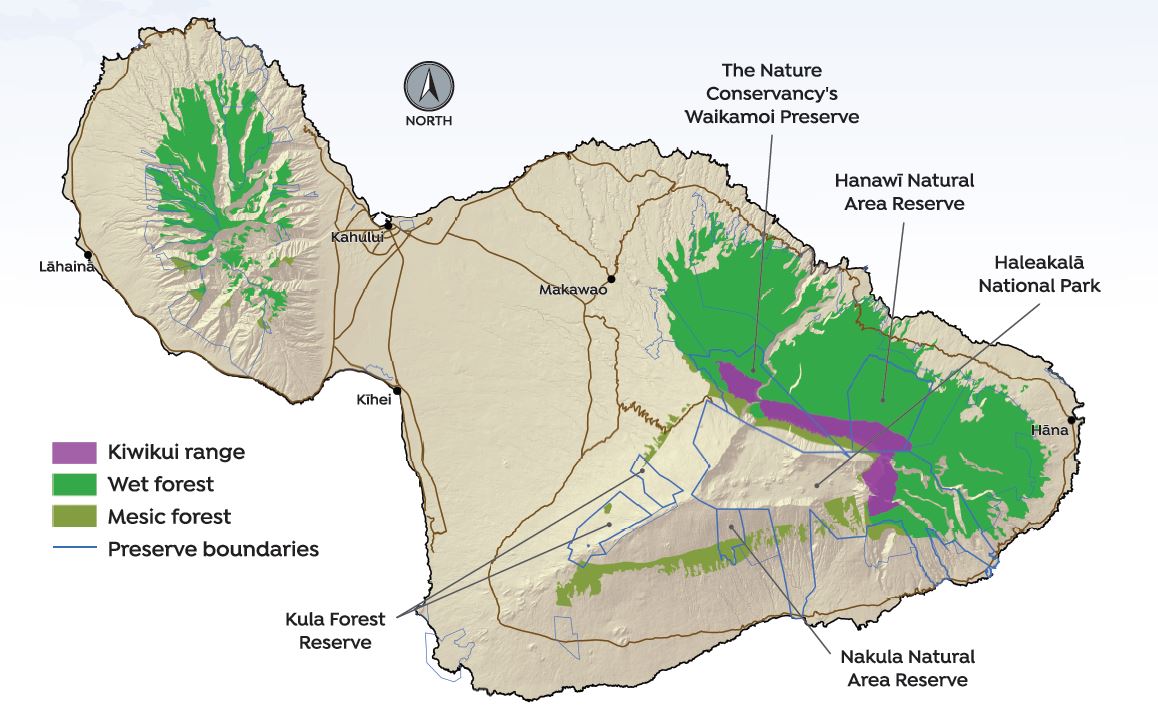
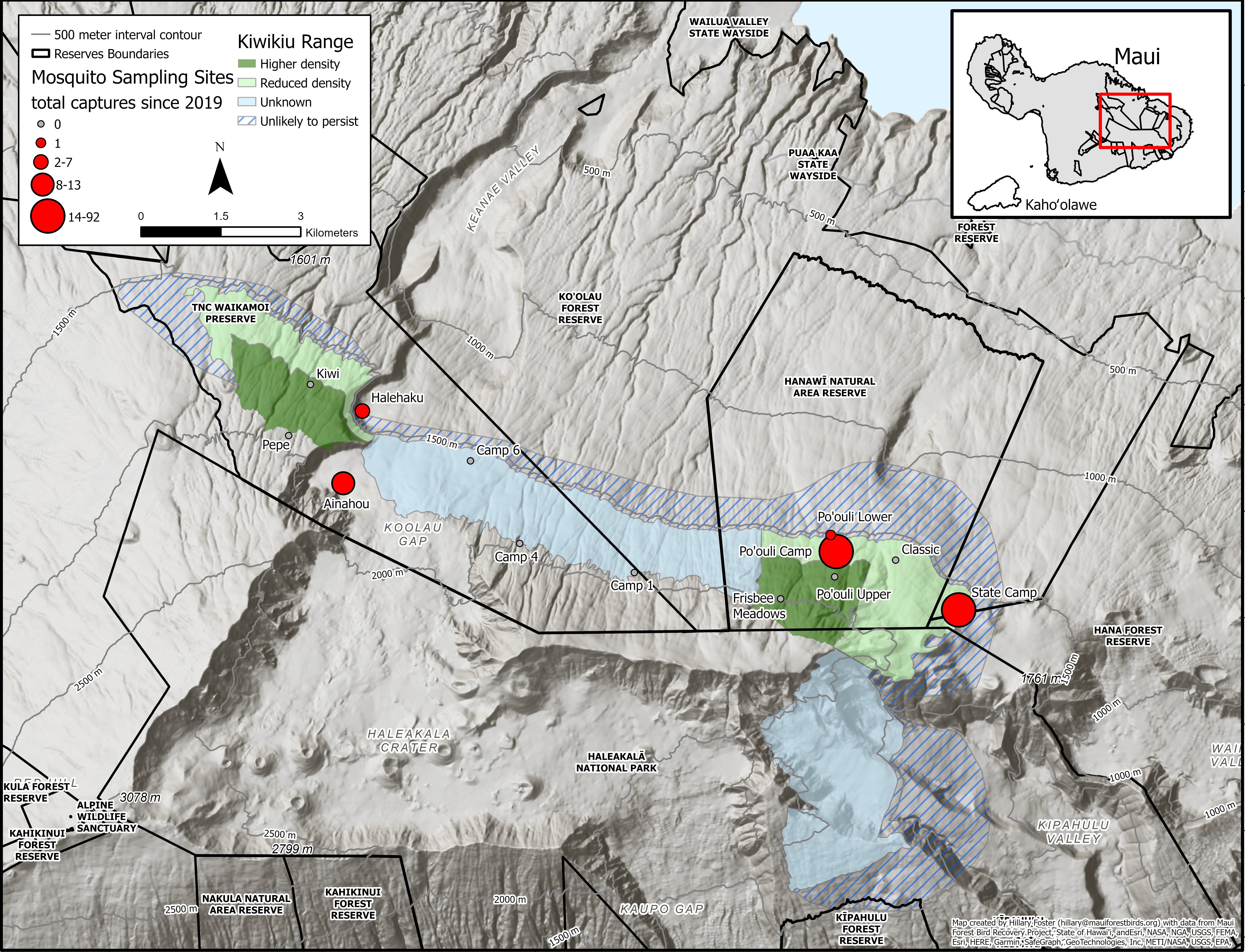
For instance, we use GIS to map the activities of banded kiwikiu to determine the density of breeding pairs within a portion of Hanawi Natural Area Reserve and The Nature Conservancy’s Waikamoi Preserve. We use GIS to model the effects of climate change on movement of malaria upslope and probable decline in forest habitat for endangered native birds. Our habitat management efforts also incorporate GIS techniques to map fences, areas where we are conducting small mammal control, and habitat threats such as the appearance of new invasive species. We also use GIS to plan and monitor outplanting and other forest restoration activities. From this tool we can measure the area of restored forest, track planting areas, and estimate current tree canopy coverage at restoration sites.
GIS is very helpful for creating colorful and clear visual illustrations of our work for seminars, posters, and public outreach programs. It is a big improvement in clarity and accuracy over hand drawn maps, which were the norm prior to the advent of GIS.
GIS also makes it easier for us to share data with other scientists in order to collaborate on various conservation efforts and evaluations throughout the Hawaiian islands. We use GIS in the field to navigate along trails and to important locations. We collect data using data collection forms linked to ArcGIS to streamline data analysis and reporting.
Below are two examples of MFBRP GIS maps. In the first, we map out locations of preserves and forest types within the kiwikiu range. In the second, we have the quantity of mosquitoes captured at various sites on Windward East Maui in relation to the kiwikiu range.
Save the Forest, Save the Birds
It takes a community of dedicated individuals and support to make conservation happen


